SSTEC Colombia, DJUB Peru
Development
2015-01-01
Vehicle Tracking GPS System
A complete solution for vehicle companies, offering real-time GPS tracking, comprehensive reporting, and customizable alerts for efficient fleet management.
System Overview
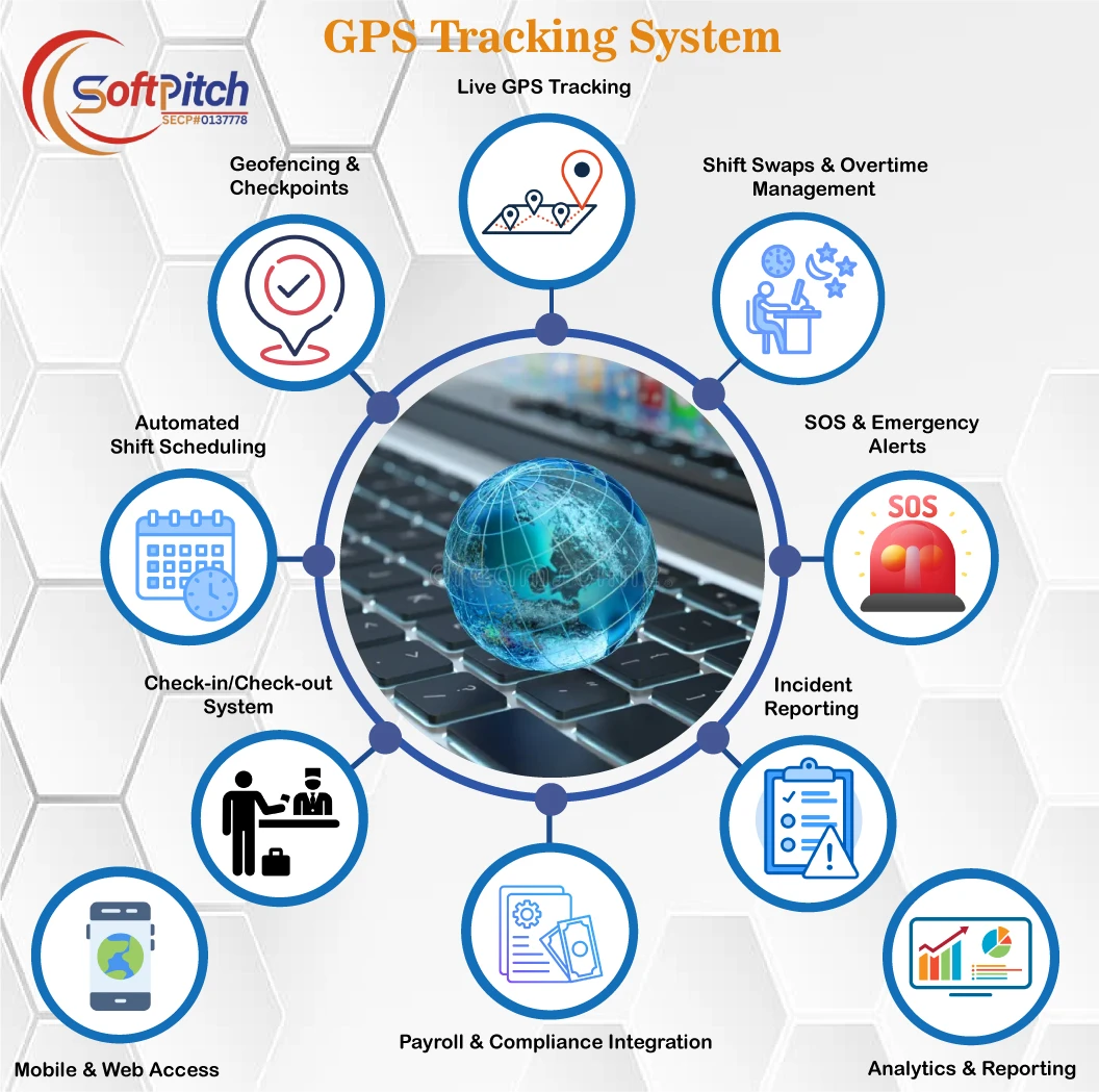
The Vehicle Tracking GPS System is a robust platform designed for vehicle companies to monitor fleets in real-time, generate detailed reports, and manage operations efficiently. With advanced mapping, customizable alerts, and comprehensive management tools, it ensures optimal fleet performance and operational transparency for super admins, company admins, and operators.
Technology Stack
Front-End Technologies
- HTML5: Provides a structured foundation for web interfaces.
- Bootstrap: Ensures responsive, mobile-friendly layouts for seamless user experiences.
- CSS3: Enhances visual appeal with modern styling and animations.
- JavaScript: Adds interactivity for dynamic web functionalities.
- jQuery: Simplifies DOM manipulation for real-time updates.
- Leaflet Map Open Source: Powers interactive, open-source mapping for vehicle tracking.
Server-Side Technologies
- PHP: Handles server-side logic for robust application performance.
- MySQLi: Manages data storage with a reliable and efficient database.
- CodeIgniter: Provides a lightweight PHP framework for rapid development.
Tracking Script
- Node.js: Enables real-time tracking scripts for accurate vehicle monitoring.
Hardware
- TK06, Meitrack GPS Trackers (MT90, MVT100, MVT340, T355, MVT380, MVT800, MVT600, T1, T3, T333, TC68S, T322X, T311): Reliable GPS devices for precise vehicle tracking.
- Android Devices: Support mobile app integration for tracking and management.
Features
Dashboard and Mapping
- Dashboard: Displays overall statistics, including vehicle status, alerts, and fleet performance metrics.
- Tracking Map: Visualizes real-time vehicle locations with pushpins, Points of Interest (POI) hide/show options, and zone overlays.
- Group Map: Monitors multiple vehicles by group, with options to hide/show groups and locate specific vehicles.
- Individual Map: Tracks a single vehicle with a detailed tracking line and pushpin points, shareable via WhatsApp, SMS, or email.
- Multiple Map: Displays multiple vehicles simultaneously for comprehensive fleet oversight.
Reporting
Comprehensive reporting tools with customizable filters (date, vehicle) and export options (Excel, CSV, PDF, Print) with hide/show column functionality.
- Event Report: Displays a vehicle’s full path on a map for a specific date, detailing its movements.
- Distance Report: Calculates total distance covered by a vehicle within a selected date range.
- Geozone Report: Tracks vehicle entry/exit times and duration in defined zones.
- Speed Report: Identifies vehicles exceeding specified speed thresholds for safety monitoring.
- Stops Report: Lists stop points with durations exceeding 5 minutes for a given day.
- Hour Report: Summarizes total hours a vehicle was operational on a specific date.
- Position Report: Provides the last known position of a vehicle.
- Connection Report: Tracks the frequency of data transmissions from devices on a specific date.
- User Login Report: Logs user login history for security and accountability.
Management
Tools for managing system entities with add, edit, delete, listing, detail views, and export options (Excel, Print).
- Super Admin: Manages the entire system, including all companies and vehicles.
- Company: Oversees company profiles and settings.
- Company Admin: Manages company-specific users and vehicles.
- Operator: Handles selective vehicle permissions for monitoring.
- Driver: Manages driver profiles and assignments.
- GSM SIM: Tracks SIM cards used in tracking devices.
- Tracking Device: Configures and monitors GPS devices (e.g., Meitrack models).
- Vehicle: Manages vehicle details and assignments.
- GeoZone: Defines geographic zones for monitoring and alerts.
- Map Point (POI): Sets Points of Interest for key locations.
- Document: Manages vehicle-related documents (e.g., licenses, registrations).
- Invoice: Tracks billing and payment records.
Icons and Alerts
- Default Icon: Manages default map icons (add, list, delete).
- Vehicle Map Icon: Customizes icons for vehicles on the map.
- POI Map Icon: Configures icons for Points of Interest.
- Alerts Configuration: Sets up alerts with add, edit, and delete options.
- Zone Alert: Notifies when vehicles enter or exit defined geozones.
- Speed Alert: Alerts for vehicles exceeding speed limits.
- Alarm Alert (SOS): Triggers notifications for emergency situations.
- Ignition Alerts: Monitors vehicle ignition status changes.
- Alert Message Customization: Edits alert messages for clarity and specificity.
User Roles and Permissions
Overview
The system supports three user roles with tailored permissions to ensure secure and efficient operations:
- Super Admin: Full access to the entire system, including all companies, vehicles, and configurations.
- Company Admin: Access to company-specific data, vehicles, and user management within their organization.
- Operator: Limited access to specific vehicles, focusing on monitoring and basic reporting.
Permission Chart
| Feature | Super Admin | Company Admin | Operator |
|---|---|---|---|
| Dashboard | ✔ | ✔ | ✔ |
| Tracking Map | ✔ | ✔ | ✔ |
| Group Map | ✔ | ✔ | ✔ |
| Individual Map | ✘ | ✔ | ✘ |
| Multiple Map | ✘ | ✔ | ✘ |
| Event Report | ✘ | ✔ | ✔ |
| Distance Report | ✘ | ✔ | ✘ |
| Geozone Report | ✘ | ✔ | ✘ |
| Speed Report | ✘ | ✔ | ✘ |
| Stops Report | ✘ | ✔ | ✘ |
| Hour Report | ✘ | ✔ | ✘ |
| Position Report | ✔ | ✔ | ✔ |
| Connection Report | ✘ | ✔ | ✔ |
| User Login Report | ✔ | ✔ | ✔ |
| Super Admin Management | ✔ | ✘ | ✘ |
| Company Management | ✔ | ✘ | ✘ |
| Company Admin Management | ✔ | ✔ | ✘ |
| Operator Management | ✔ | ✔ | ✘ |
| Driver Management | ✘ | ✔ | ✘ |
| GSM SIM Management | ✔ | ✘ | ✘ |
| Tracking Device Management | ✔ | ✘ | ✘ |
| Vehicle Management | ✘ | ✔ | ✘ |
| GeoZone Management | ✘ | ✔ | ✘ |
| Map Point (POI) Management | ✘ | ✔ | ✘ |
| Document Management | ✔ | ✔ | ✘ |
| Invoice Management | ✔ | ✔ | ✘ |
| Vehicle Map Icon | ✔ | ✘ | ✘ |
| POI Map Icon | ✔ | ✘ | ✘ |
| Zone Alert | ✘ | ✔ | ✘ |
| Speed Alert | ✘ | ✔ | ✘ |
| Alarm Alert (SOS) | ✘ | ✔ | ✘ |
| Ignition Alerts | ✘ | ✔ | ✘ |
| Alert Message Customization | ✘ | ✔ | ✘ |
Modules Snapshots
Key Visuals
The system includes intuitive interfaces for monitoring and managing fleets, as showcased in the following snapshots:
- Dashboard: Visualizes overall fleet statistics, including vehicle status and alerts.
- Group Map: Displays multiple vehicles by group for efficient fleet monitoring.
- Single Map: Tracks individual vehicle movements with detailed tracking lines.
- Multi Map: Monitors multiple vehicles simultaneously on a single interface.
- Reports: Provides detailed reports with export options for operational insights.
- Graphical Reports: Visualizes data trends for easier analysis.
- Zone Configuration: Allows creation and management of geozones for alerts.
- Alerts Configuration: Customizes notifications for zone, speed, and SOS alerts.
Why Choose Our Vehicle Tracking GPS System?
Our Vehicle Tracking GPS System is a powerful solution for fleet management, offering real-time tracking, detailed reporting, and customizable alerts. Built with advanced technologies like Leaflet Maps, PHP, and Meitrack GPS devices, it ensures reliability and scalability. Features like geozone alerts, speed monitoring, and comprehensive management tools empower vehicle companies to optimize operations, enhance safety, and improve efficiency. Get started with free training and ongoing support to transform your fleet management today.
No gallery images for this project.
No packages available for this project.